
October 17th, 2025 Local News
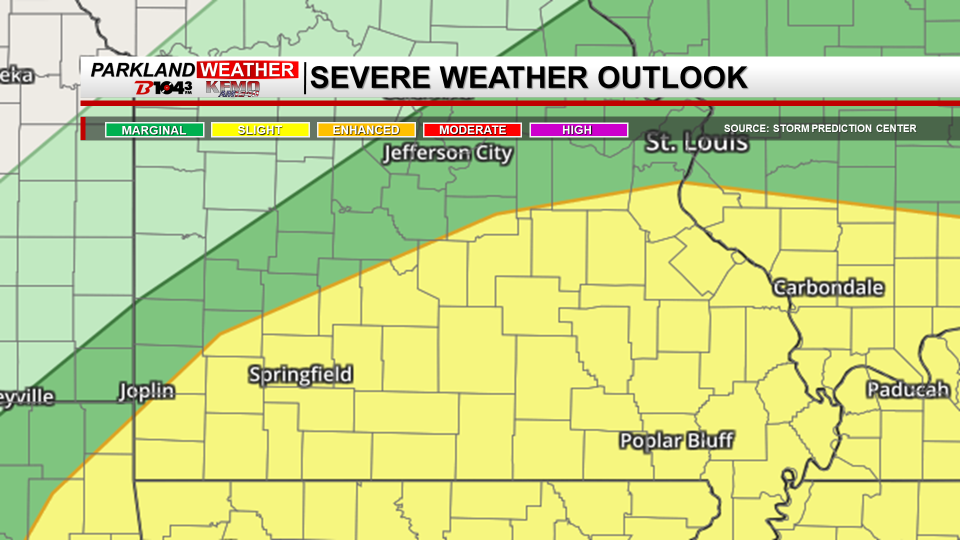
Park Hills, Mo. (KFMO) - Showers and thunderstorms are expected across the Parkland on Saturday as a cold front moves through the region.
The greatest threat for severe weather will be between noon and 6 p.m., mainly in southeast Missouri and southwest Illinois. The National Weather Service says the Parkland remains under a slight risk for severe weather. Damaging winds and large hail are the primary threats, with locally heavy rainfall also possible. A tornado or two cannot be ruled out.
If severe storms develop, the potential hazards could include weak EF0 to EF1 tornadoes, quarter-size hail, and wind gusts up to 60 miles per hour.
Forecasters urge residents to monitor weather updates and have multiple ways to receive warnings throughout the day Saturday.